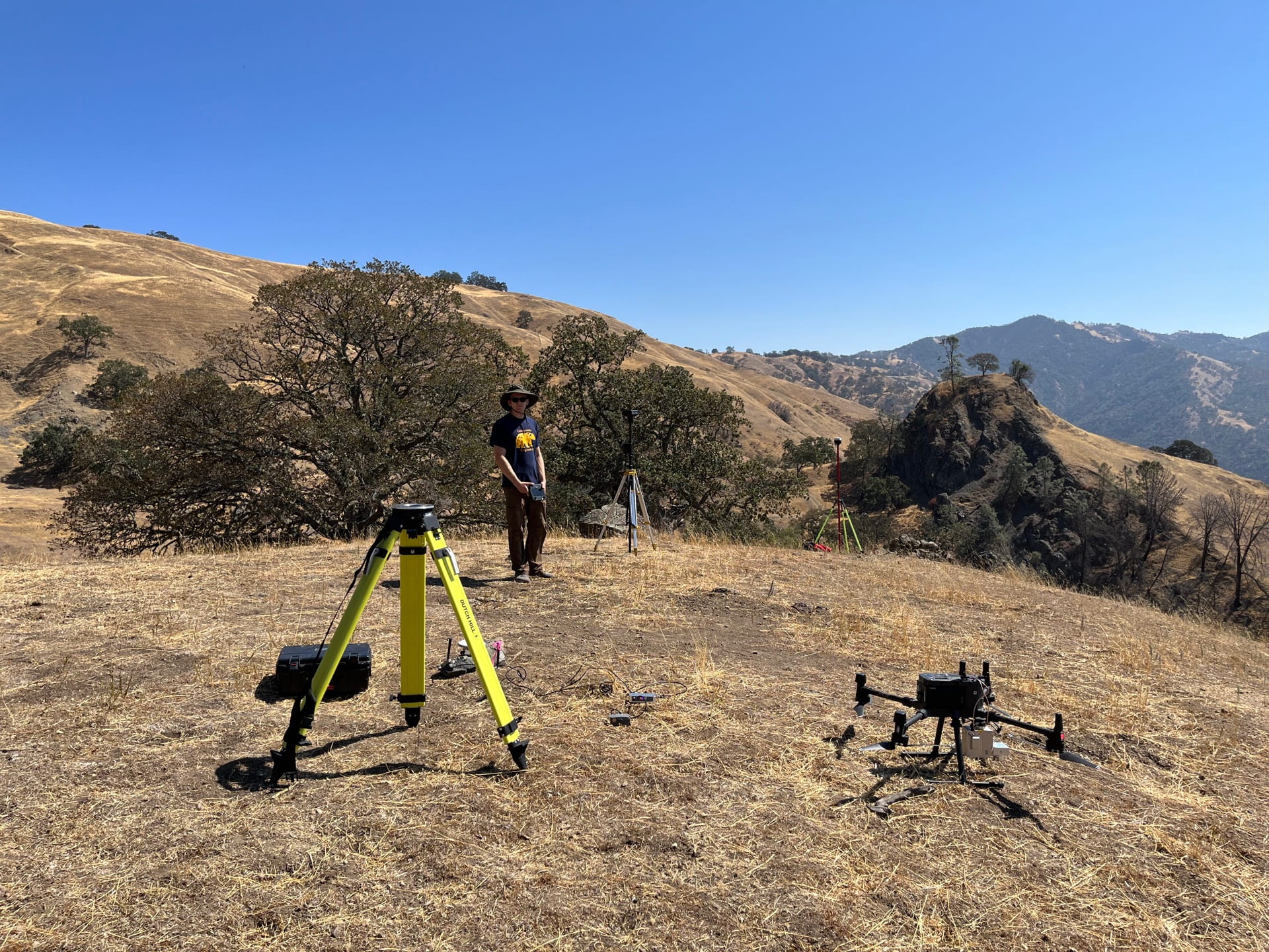
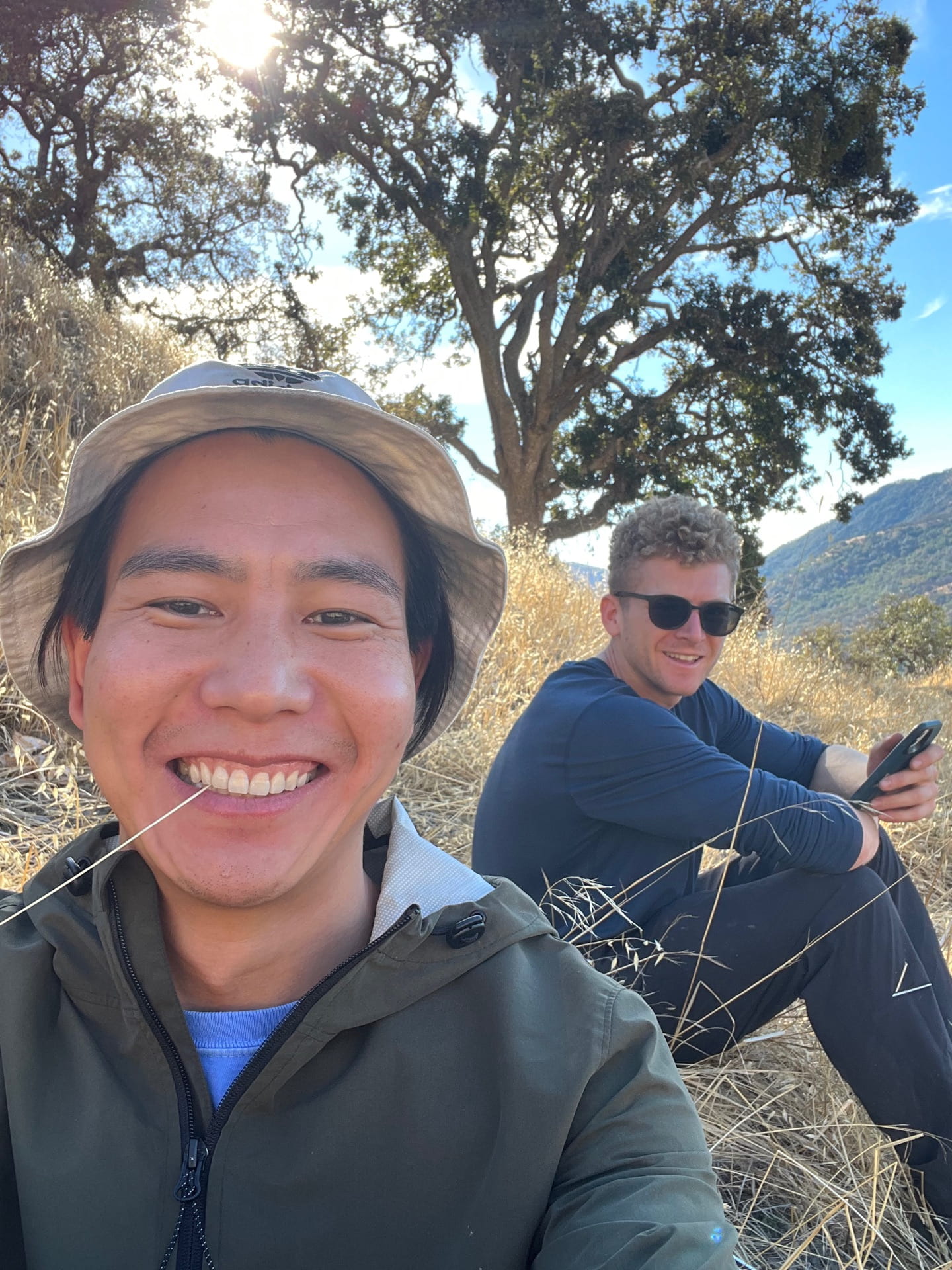
2022 Winter – Monitoring the Oak Ridge slide in California
Image #1: Using drone-based lidar and thermal sensors for landslide monitoring. Image #2: Drew and I were having a happy selfie time. Little did we know the drone would commit suicide later that day :(( It turned out to be not our fault at all one week later, but we were so bummed before knowing that.
*click photo to view in full size
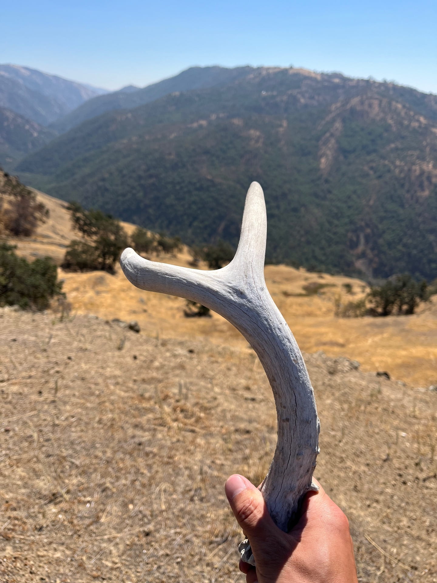
Image #1: I found a deer antler out there! Image #2: Noah and his continuous GPS station on the slide.
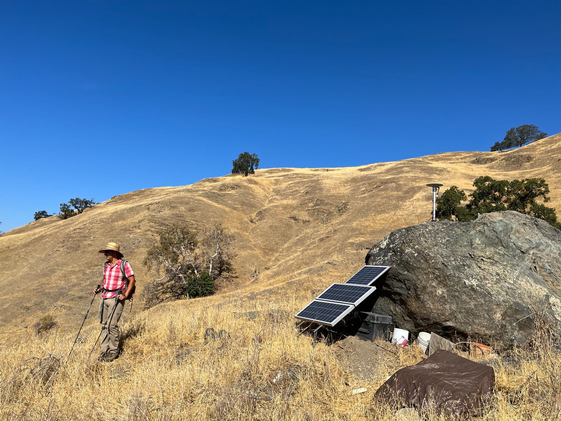
*click photo to view in full size
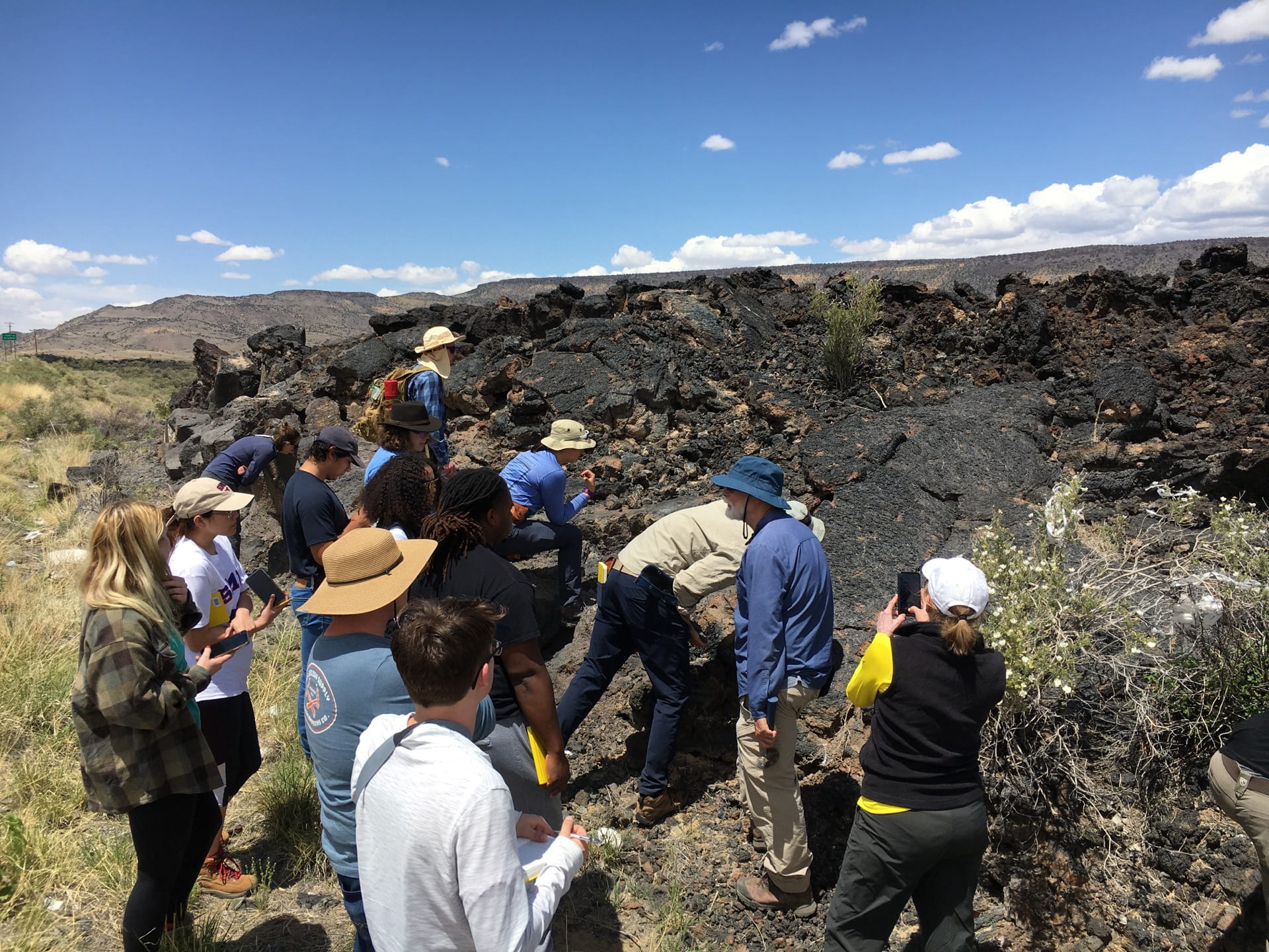
2022 Fall – Deploying sensors on the Slumgullion slide in Colorado
One of the landslide “celebrities”, the Slumgullion slide in Colorado, moves more than 1 cm in a day (Image #1). Image #2: Digging a trench to measure strain within the landslide body. After 3 days of trench digging, you get to know watching it is way more enjoyable than doing it ..
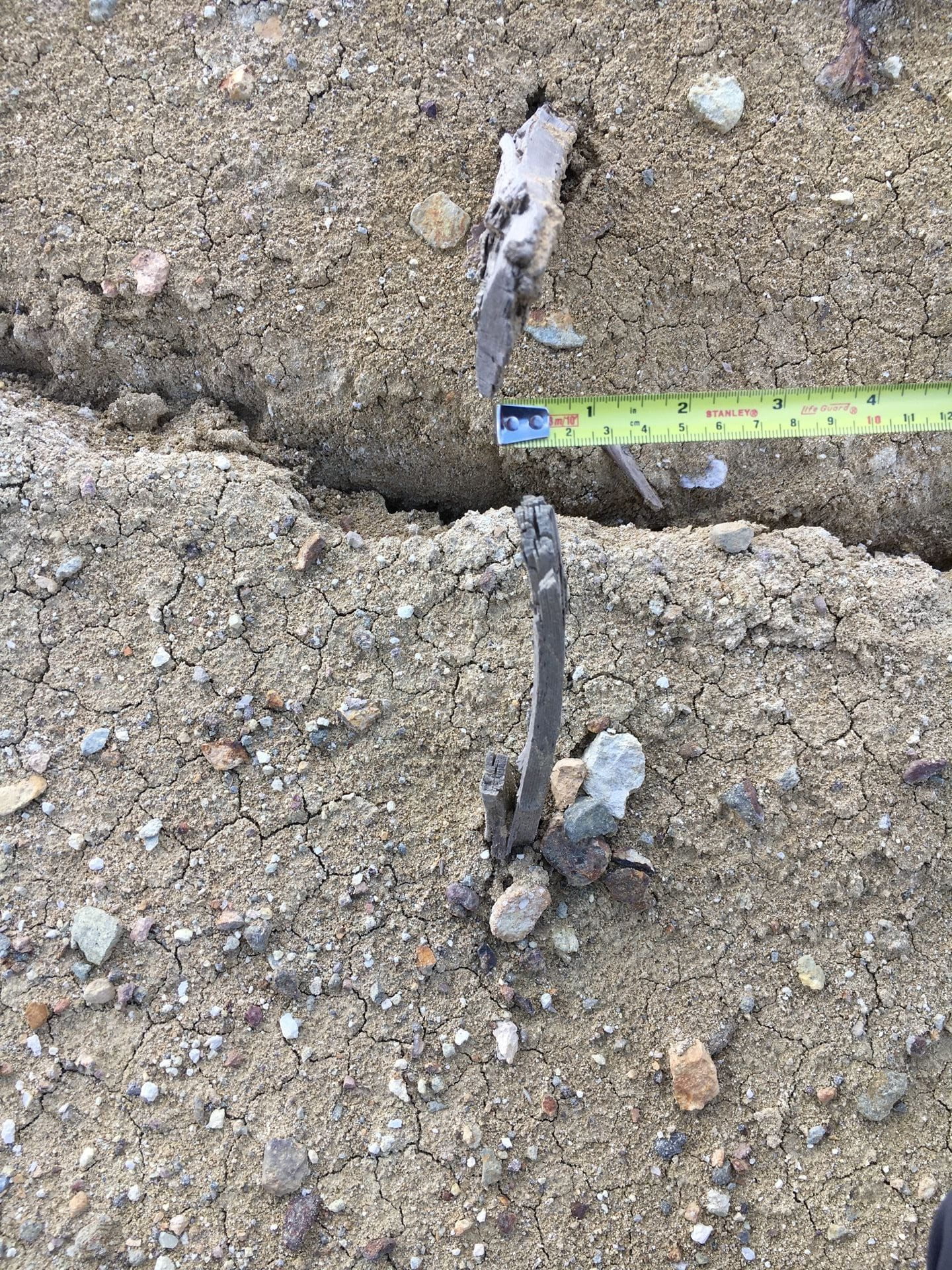
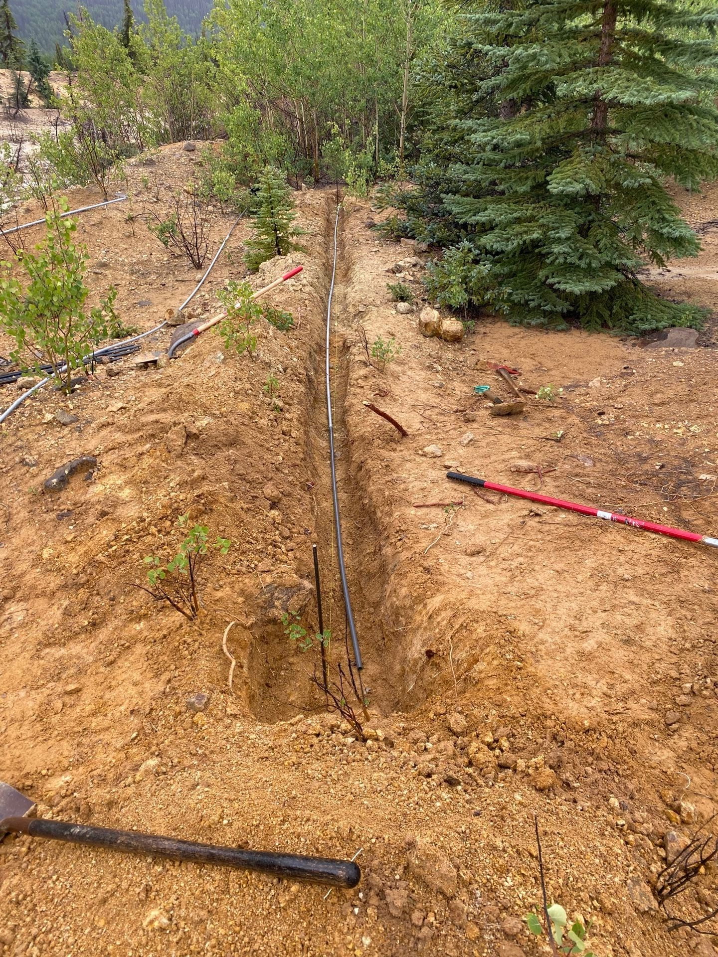
*click photo to view in full size
Image #1: Kimber and I were very proud of our GPS deployment! Image #2: Deers are everywhere near the town.
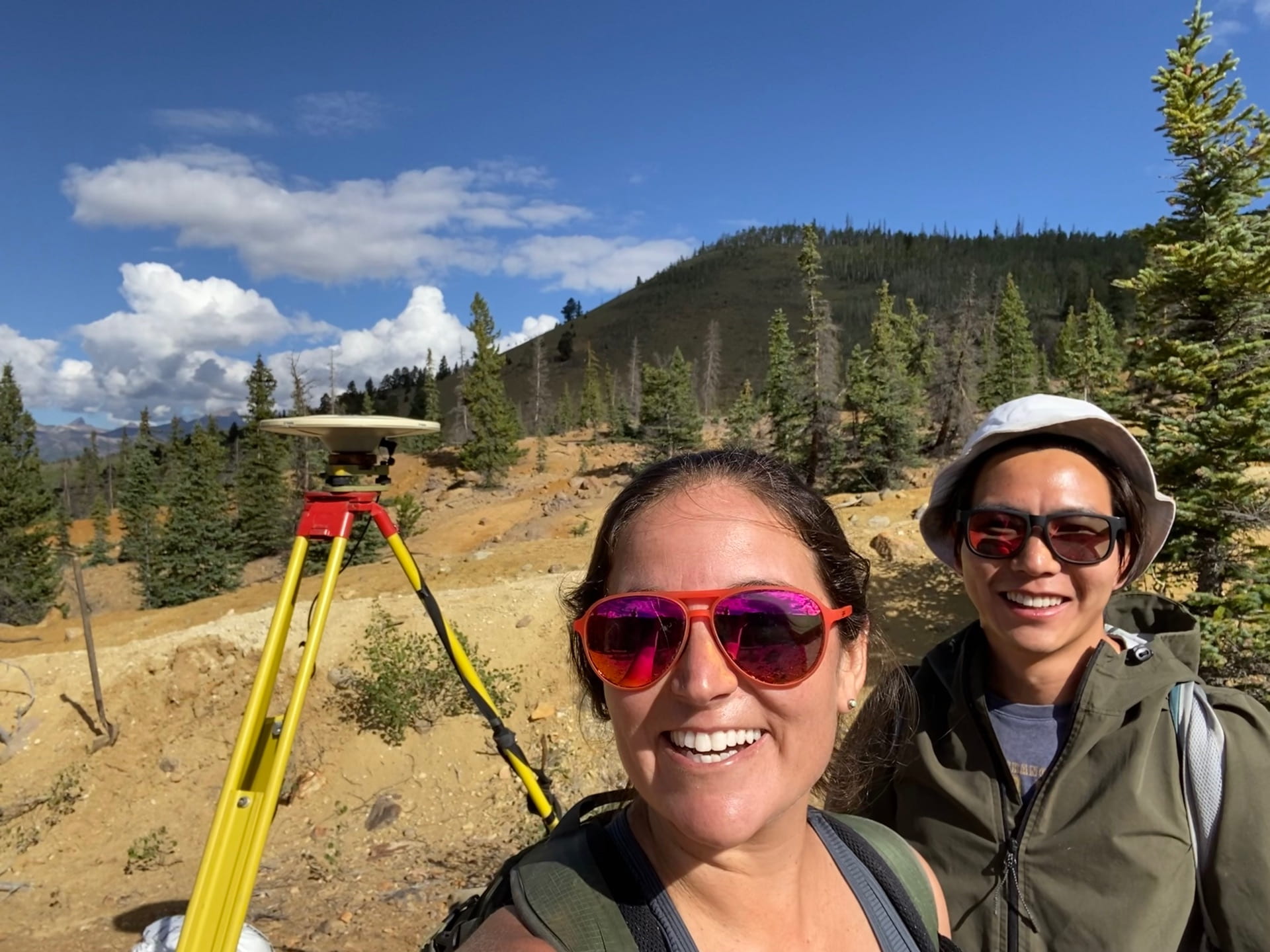
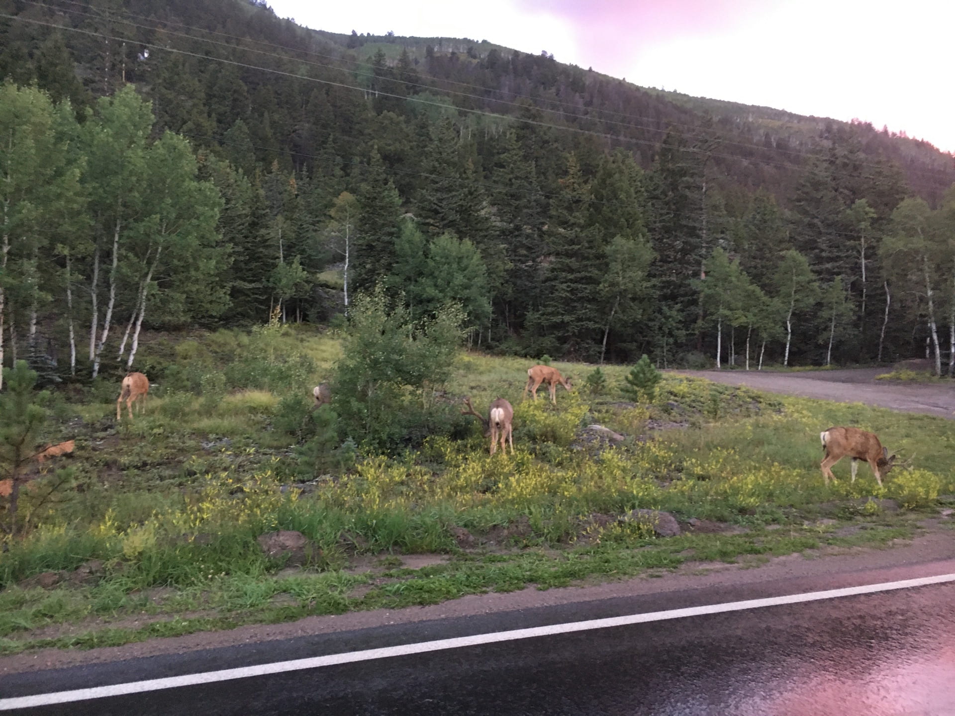
*click photo to view in full size
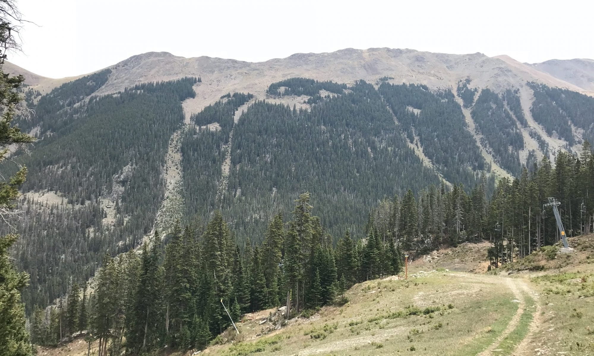
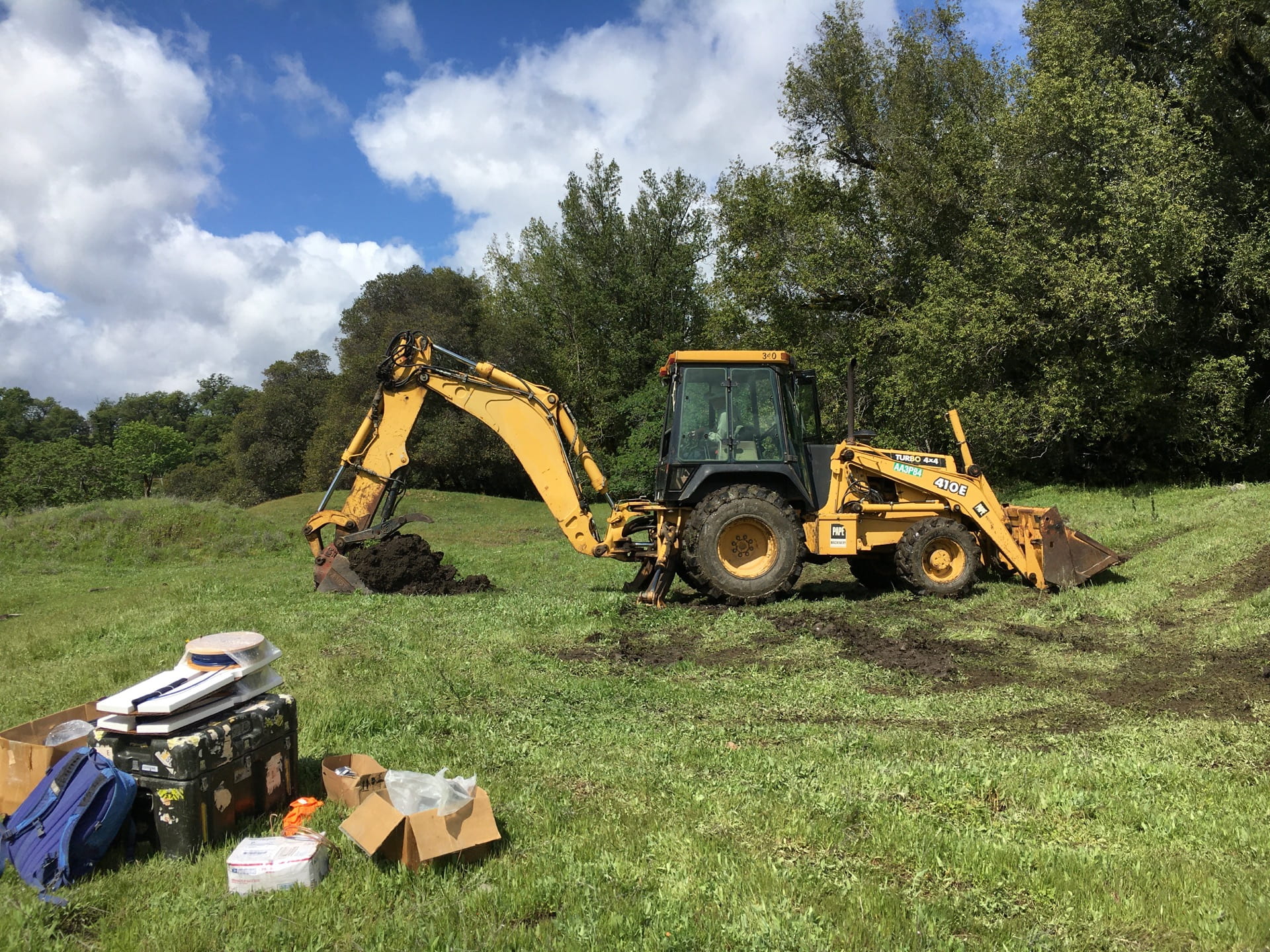
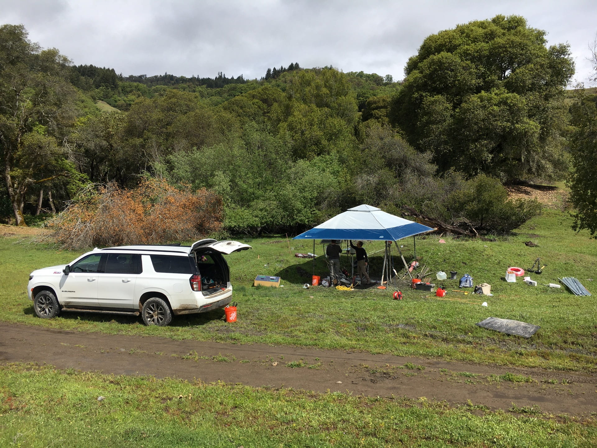
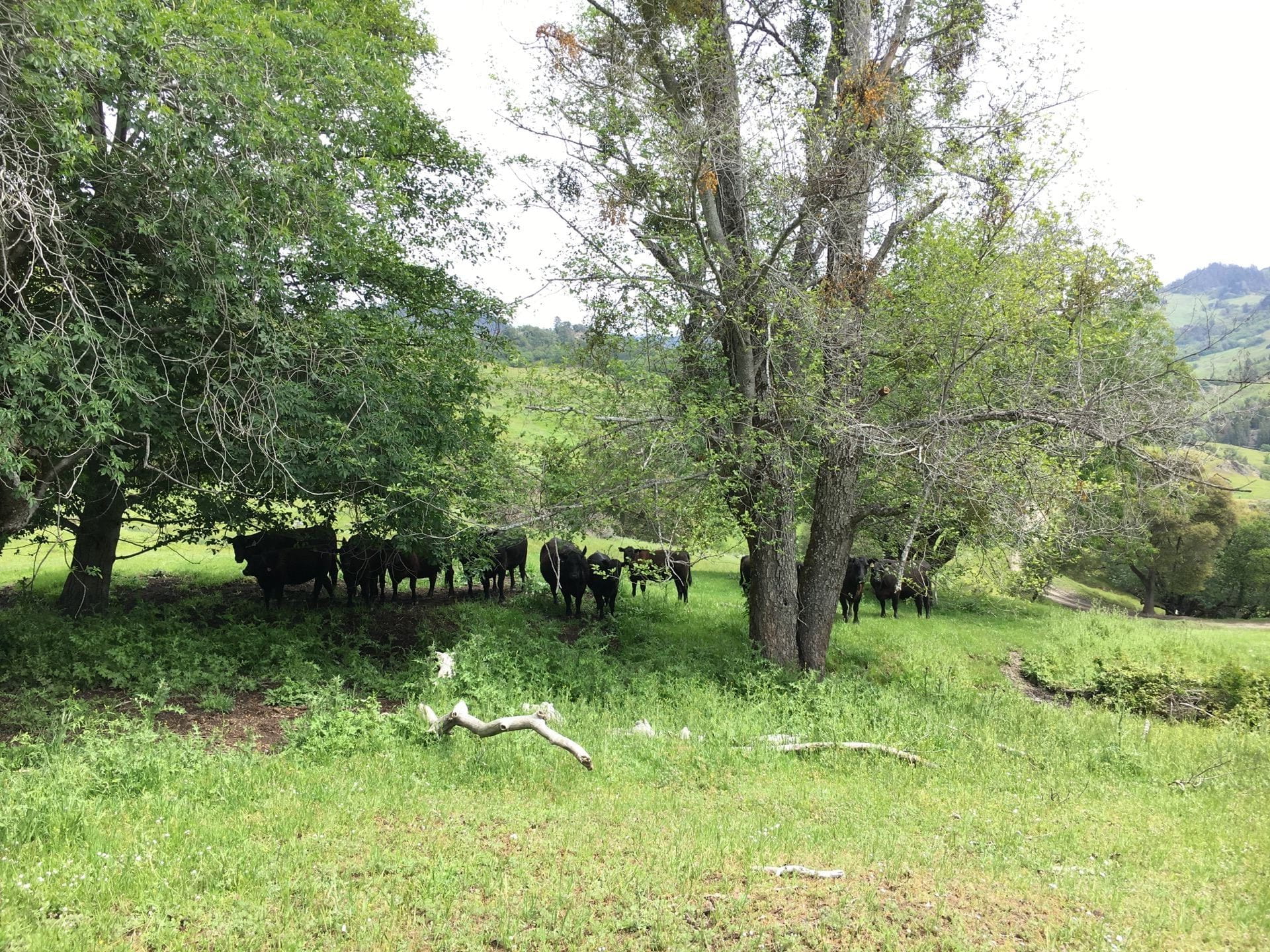
2022 Spring – Instrumenting landslides in northern California
Image #1: Bringing out our toys into the northern Califronia forest to instrument some slow-moving landslides. Image #2: The weather was pretty supportive, I mean, until sometimes it started to rain bullets and we had to use the canopy.
*click photo to view in full size
Image #1: Me drilling a borehole using jack hammer at a landslide site. Mildly proud that we managed to drill maximum 15 m deep for some landslides. Image #2: Apparently, our science project was super cool and attracted tens of fans watching us from a distance.
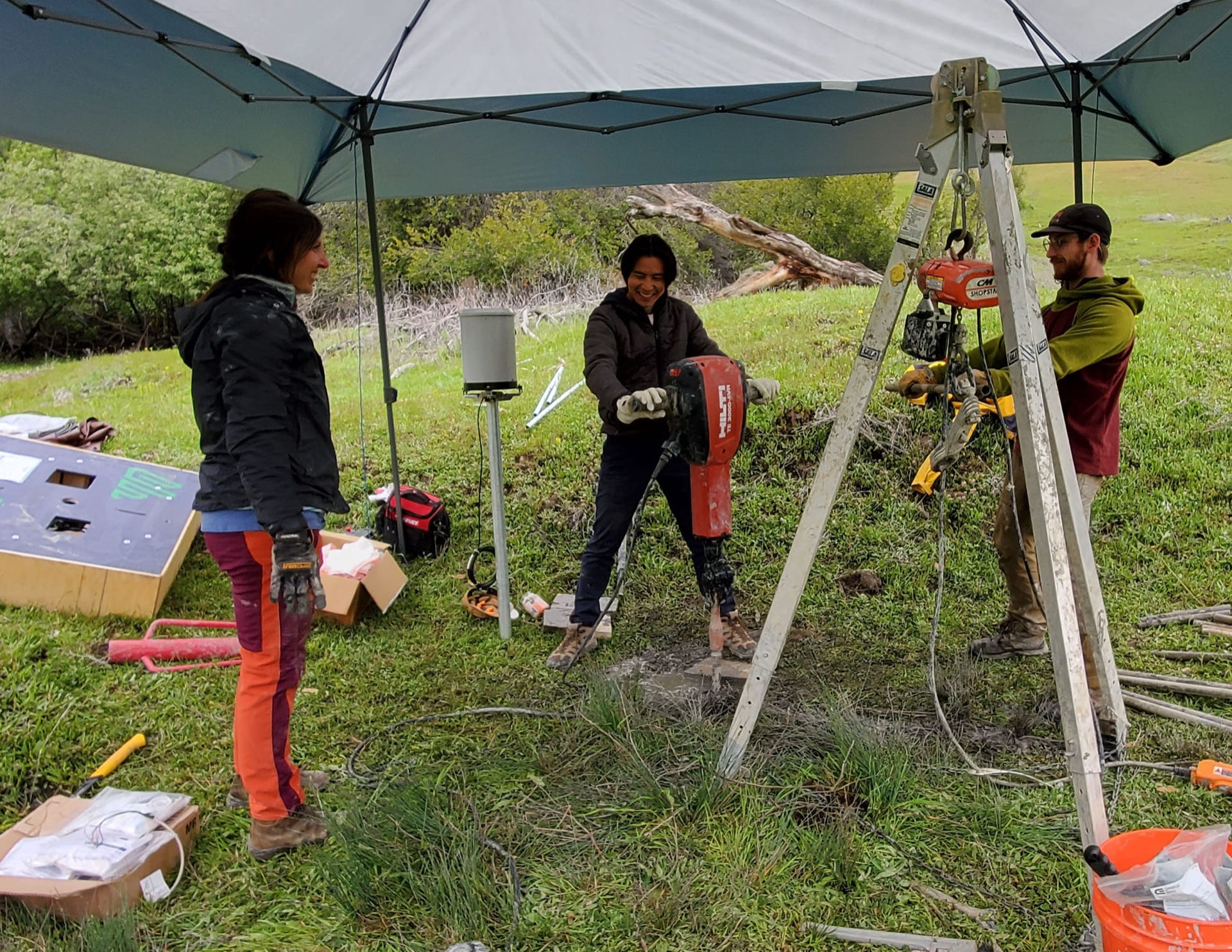
*click photo to view in full size
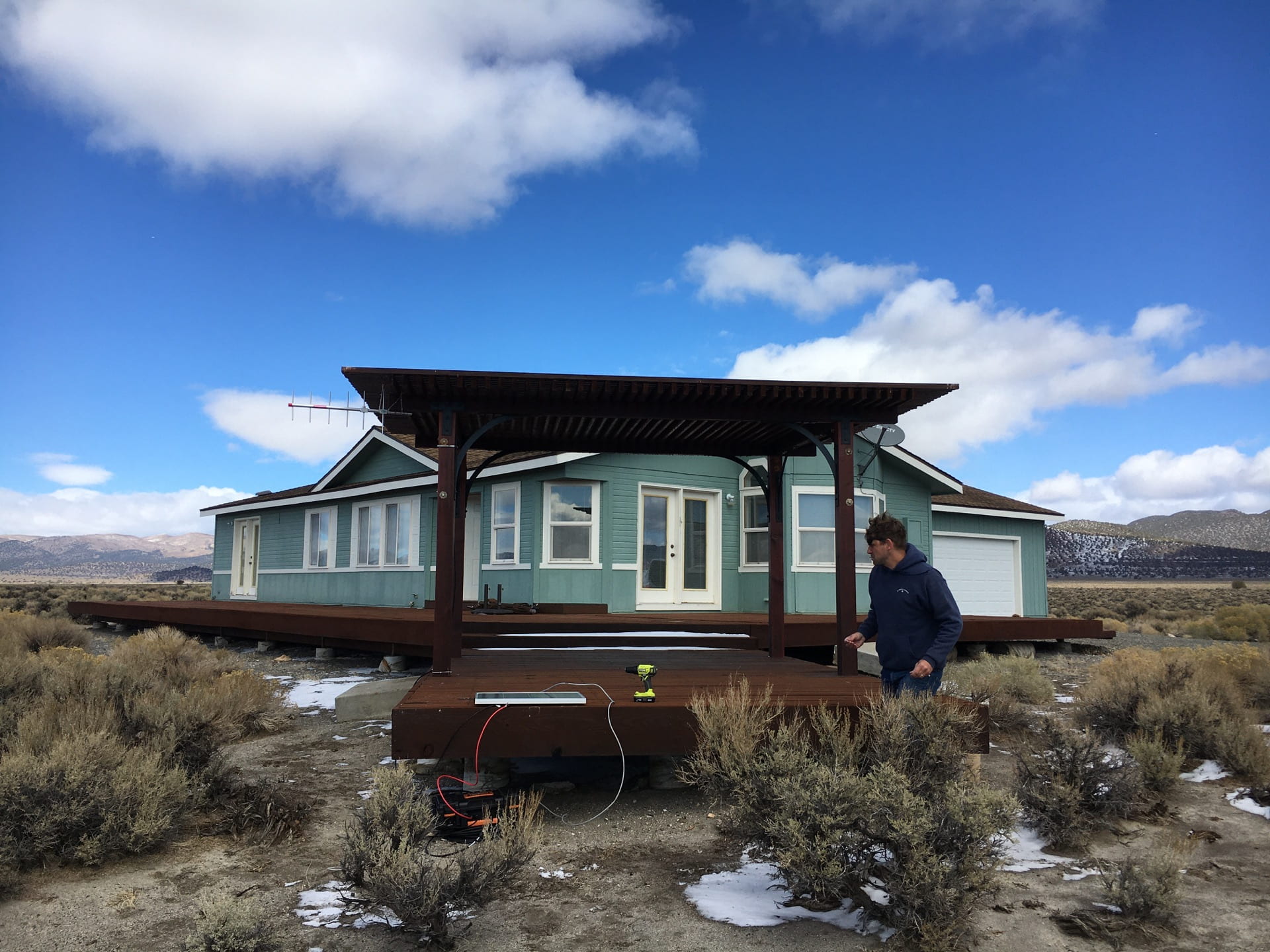
2021 Fall – Measuring heat flow at Mono Lake, California
A young volcano erupted about 300 years ago and popped up a small island at the center of Mono Lake. Image #1: Matt was setting up a solar panel for the receiver to automatically record data from thermal sensors deployed in the lake. Image #2: We were testing to use thermal cameras to catch heat anomalies near Mono Lake.

*click photo to view in full size
A bubbling hot spring at the lakeshore. The water was very warm but not boiling hot. I did not swim there, for sure…
Image #1: Me demonstrating the major usage of pumice (density of 0.7-1.2 g/cm^3): showing off muscles. Image #2: On my way to be an archaeologist: I have never seen this kind of bird in my life, so that must be some indigenous artwork…

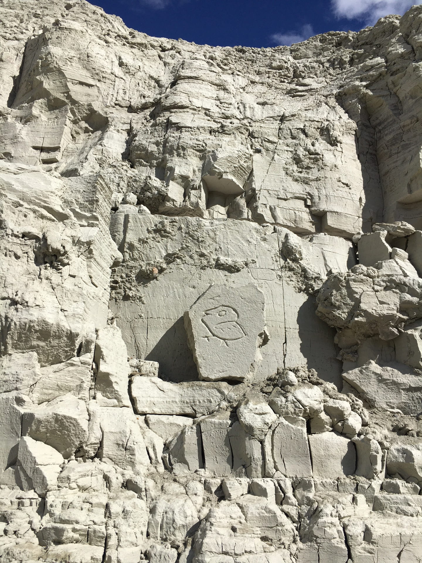
*click photo to view in full size
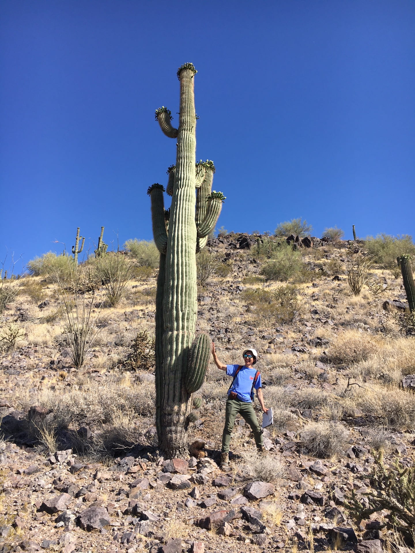
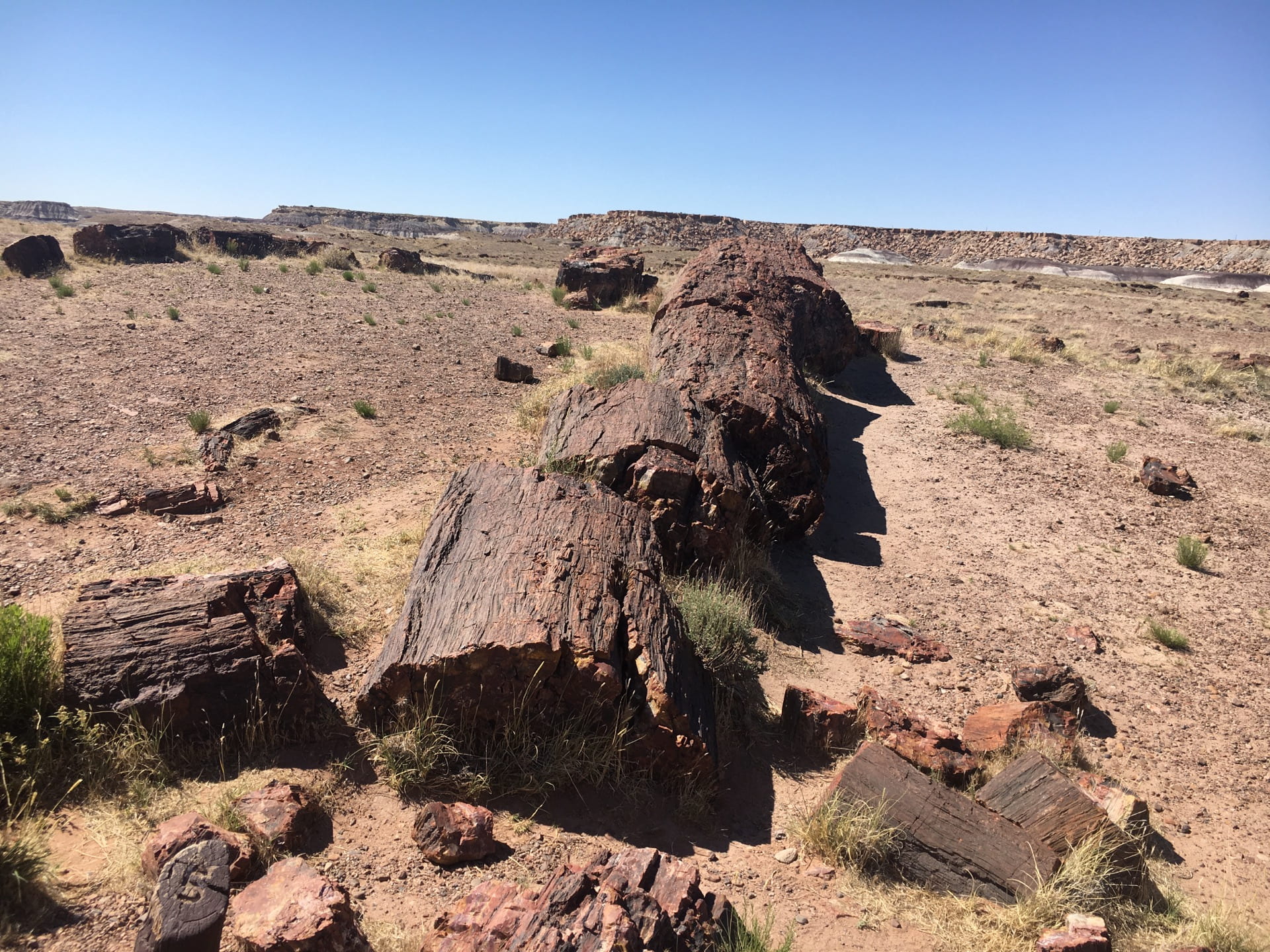
2021 Summer – Geology road trip
Image #1: Driving three vans from Texas to Arizona, we started our exciting 10-day geology trip. Yup, we camp in the middle of nowhere and we rock beside the highway! Image #2: First stop – cooled, ancient lava flow near Grants, New Mexico.
*click photo to view in full size
Image #1: Check out this giant cactus – Saguaro. This one is probably more than 100 years old judging from its size and the number of side arms . Amazing that saguaros learned to store rainwater so are able to survive the dry climate. Image #2: Petrified wood. It is absolutely nature’s magic. I was stunned to see these tree-shaped rocks for the first time.
*click photo to view in full size
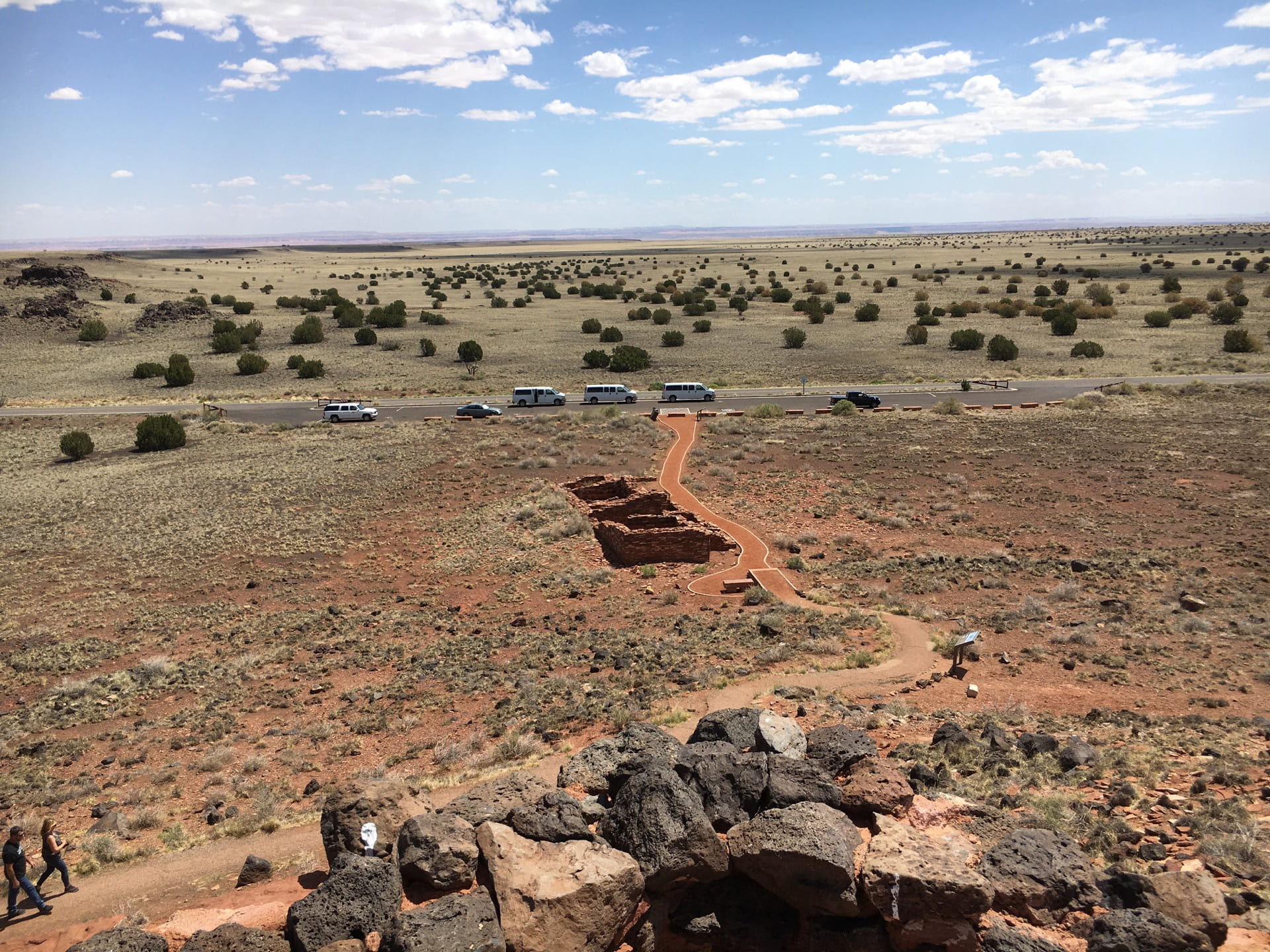
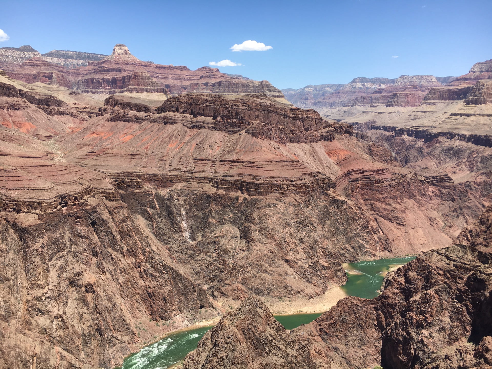
Grand Canyon, a stunning geological site shaped by the uplifting of Colorado Plateau and incision of Colorado River, is such a unique place in this world. The roughly 1800 m deep stratigraphy of the sedimentary layers was perfectly exposed to offer a fascinating visualization of Earth’s past.

*click photo to view in full size
Oh yes, similarly impressive were these adorable food robbers (image #1) at Grand Canyon. We had to have someone safeguard our backpacks while taking a group photo (image #2).
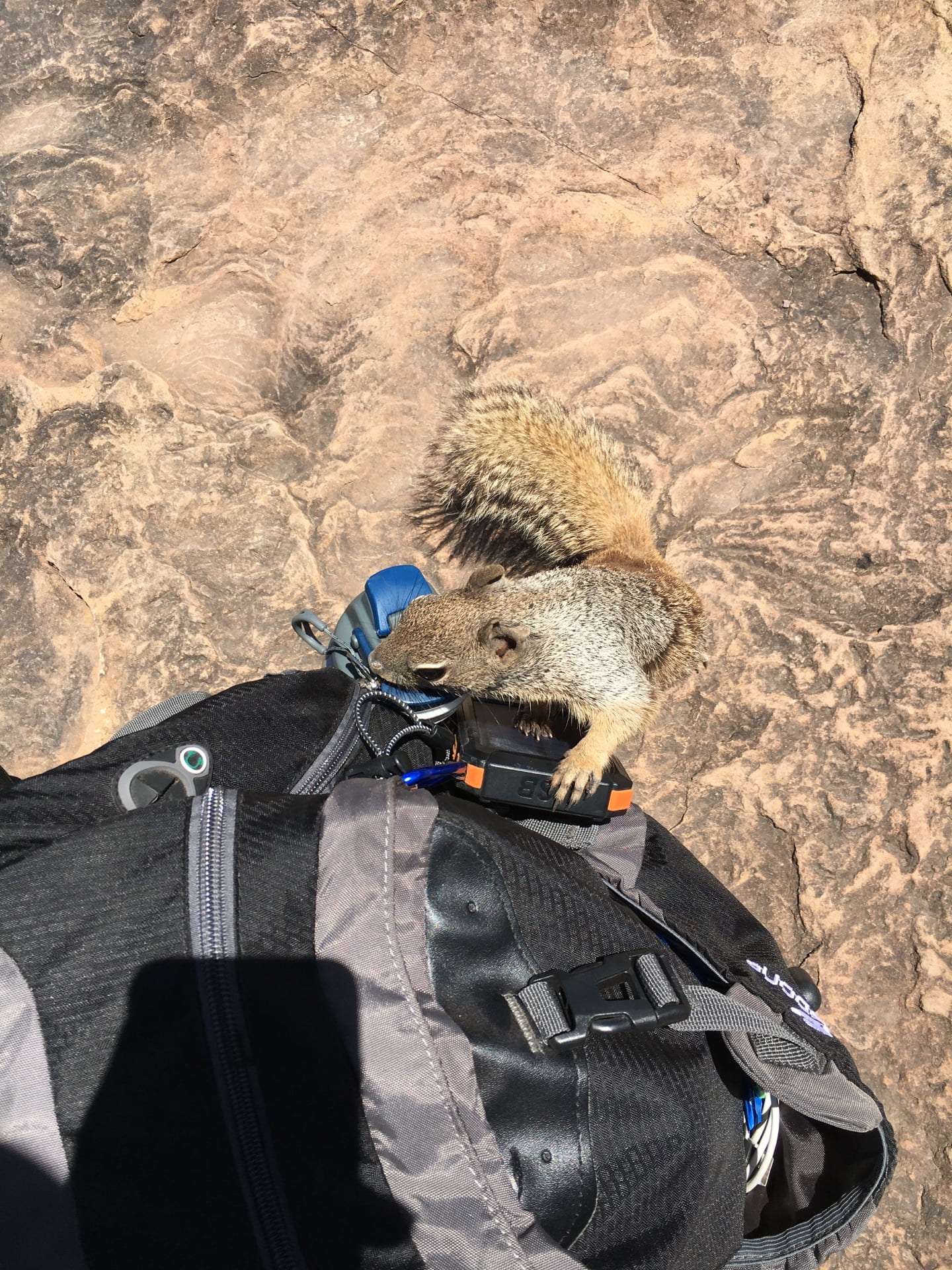

*click photo to view in full size
2020 Winter – Visiting irrigation-induced landslides in Washington
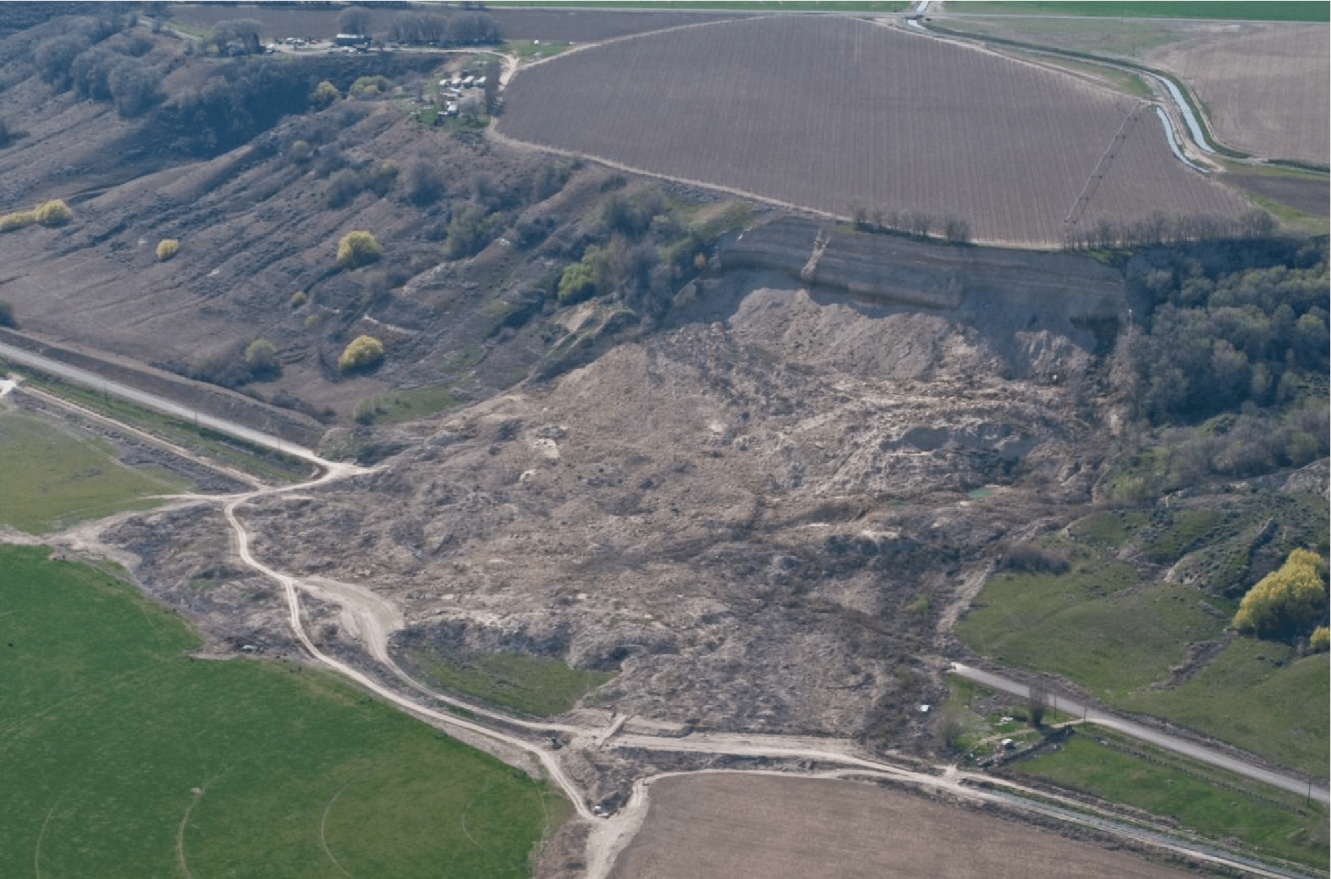
Started in 1950s, irrigation-supported intensive farming became prevalent in a Washington desert near Hanford, and the excess irrigation water led to widespread landslides in this region. Image #1: The Basin Hill landslide that destroyed local roads and houses. Image #2: An excellent example of hourglass-shaped earth flows.

*click photo to view in full size
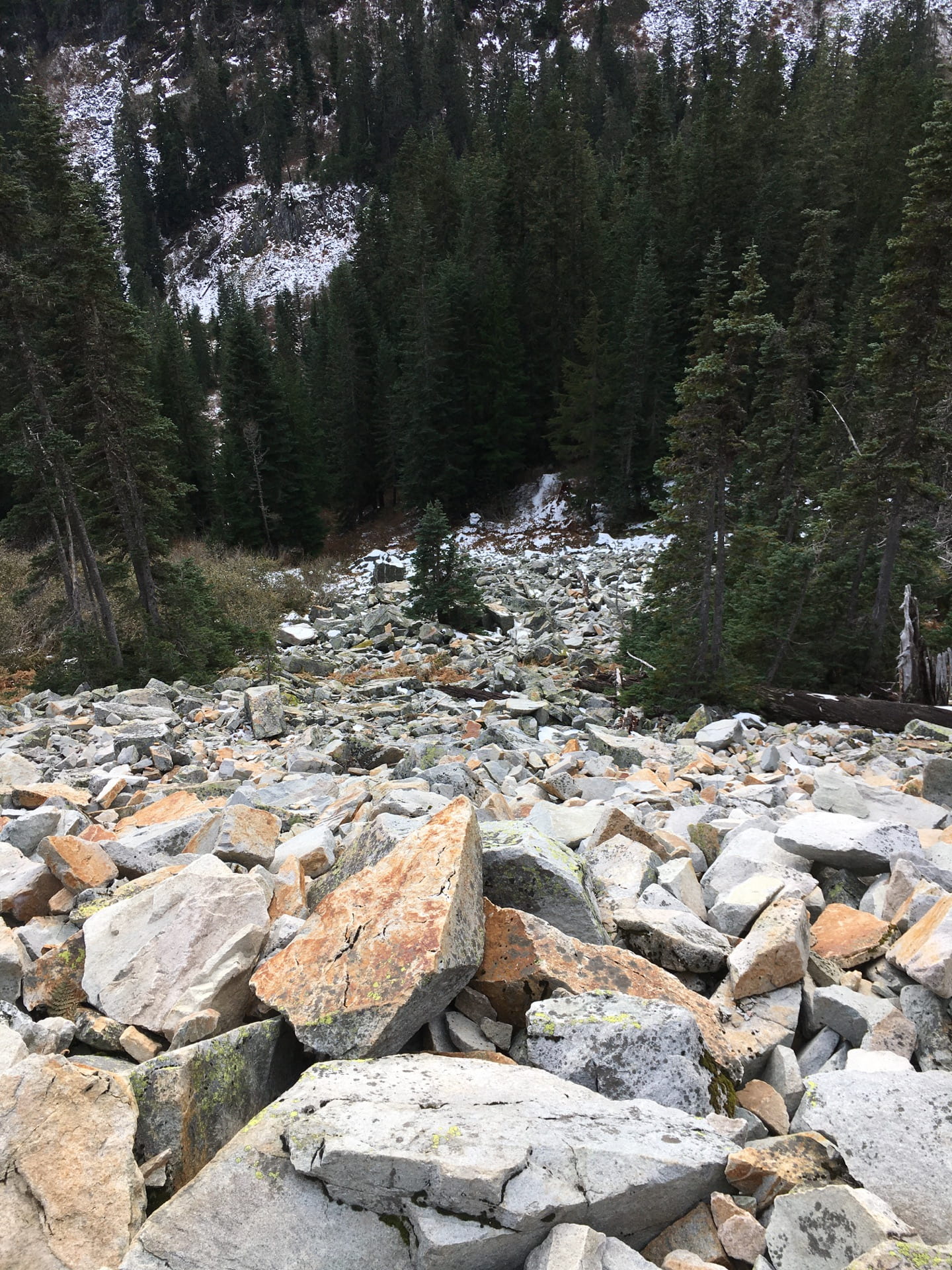
Hiking in the mountains near Seattle, I was surprised to notice the traces of landslides almost everywhere: the rockfalls beside the trails (image #1) and tilted tress (image #2)… Hiking on the jagged, slippery and icy trails was another fun experience. We parked at the foothill and almost did not make it back to our car before dark

*click photo to view in full size
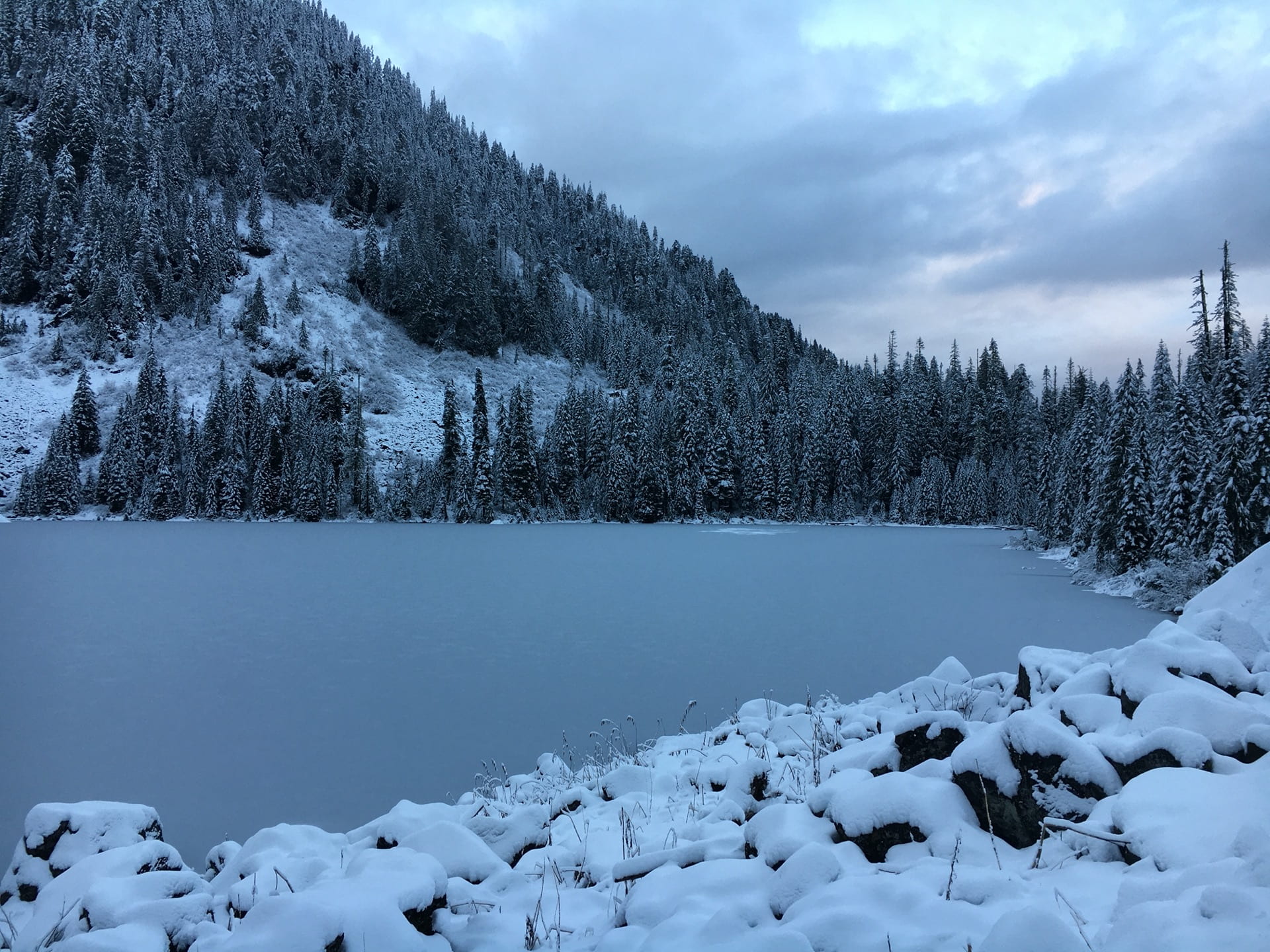
2019 Winter – Visiting the Gold Basin landslide in Washington
Right downslope of the landslide was a popular campground – Gold Basin campground (image #1). It was closed during the wet winter season for concerns of the landslide threat (image #2).


*click photo to view in full size
Headscarps of the landslide are almost vertical and could be clearly seen from the campground (image #1). A large volume of sediments were being transported down to the Stillaguamish River (image #2), destroying salmon habitat by suffocating their eggs.


*click photo to view in full size
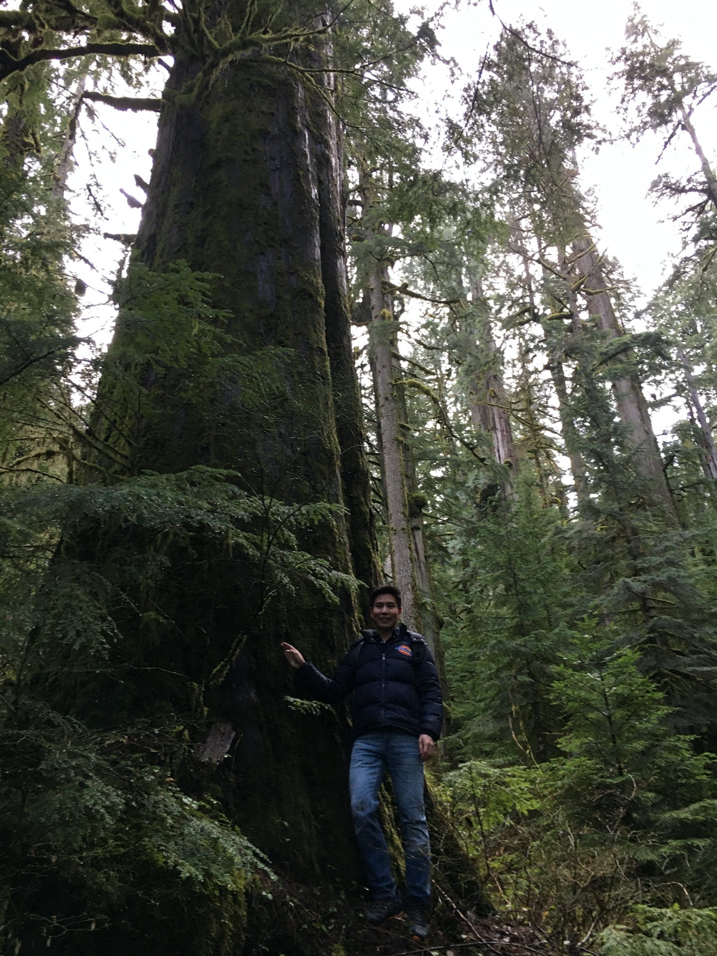
Unfortunately, I didn’t make it to cross the freezing, deep river to get unto the landslide. Instead, I hiked to a nearby high mountain, hoping to overlook the whole landslide body. Turned out it was too foggy to have a very clear view from the mountain top as well. The giant trees beside the trail (image #1) and a beautiful mountain-top lake (image #2) still worth the 2-hour hiking, nevertheless.
*click photo to view in full size
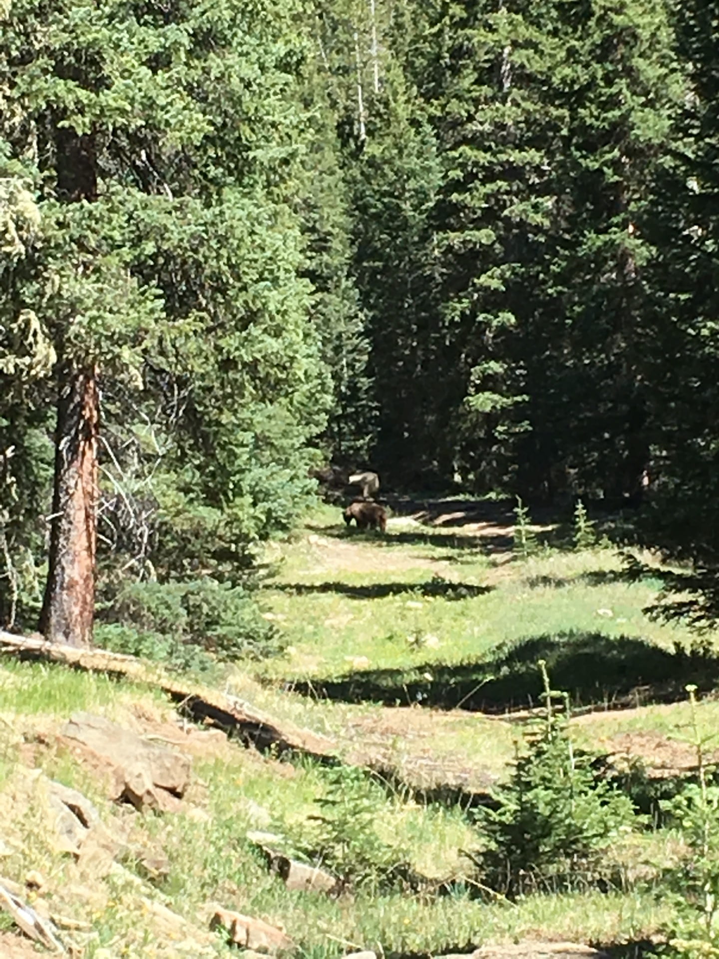
2018 Summer – Studying hydrogeology at Taos, New Mexico
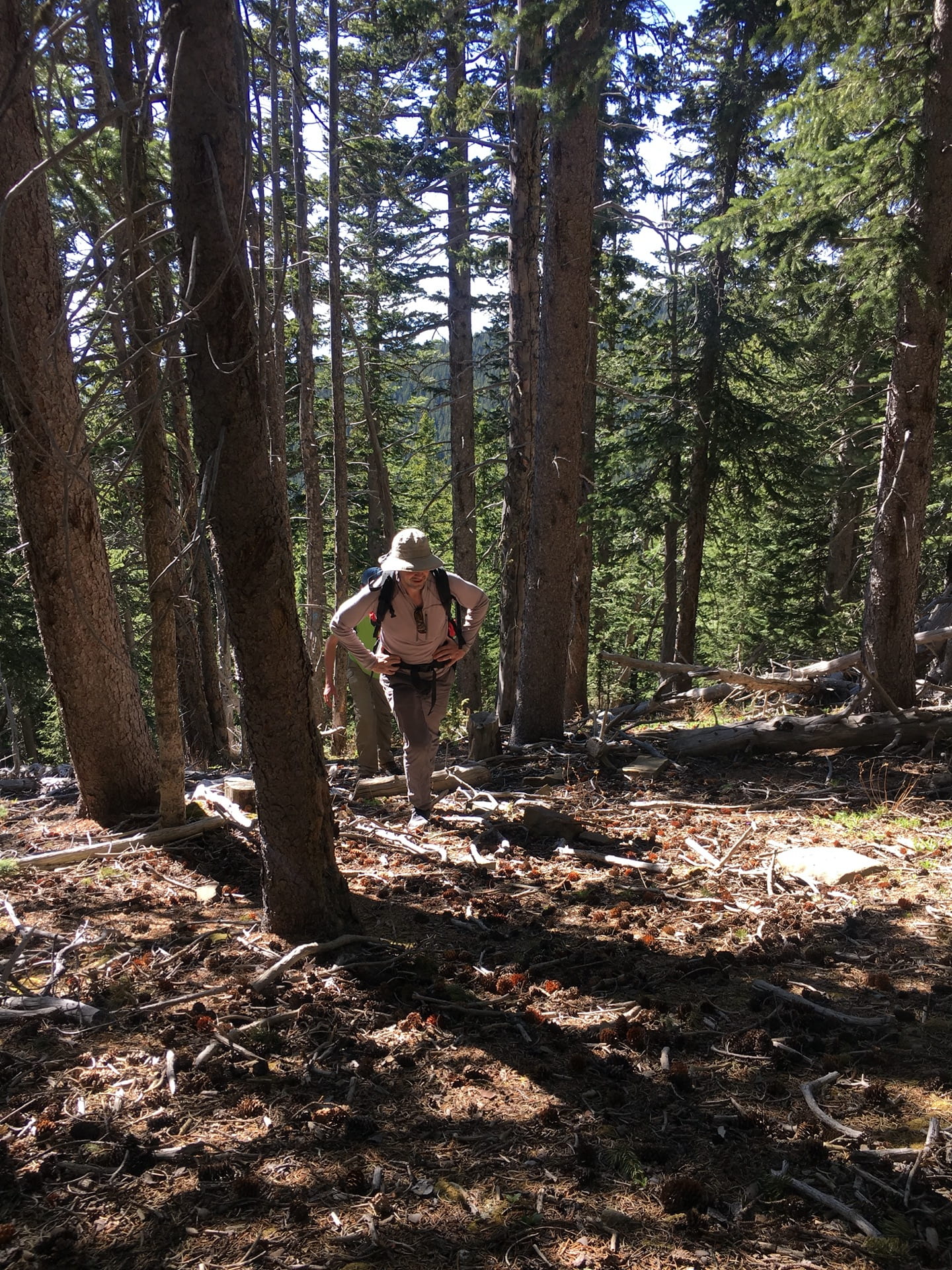
Checked out several old landslides at Taos, New Mexico, while we were hiking in the mountains (image #1). On the way to the mountain peak, we ran into a black bear (image #2) chilling on the abandoned logging road.

*click photo to view in full size
Obviously I was very excited that the bear didn’t take us for dinner (image #1). Yup that was probably a veggie bear. After 3 hours of climbing in the steep woods (image #2), we finally reached the peak and get to enjoy the beautiful mountaintop views.

*click photo to view in full size
Back to work: measuring discharge rate of a river (image #1) and testing permeability of soils (images 2 & 3).


*click photo to view in full size
Witnessed a stunning double rainbow (image #1) and a smoky wildfire (image #2) in the same week.


*click photo to view in full size
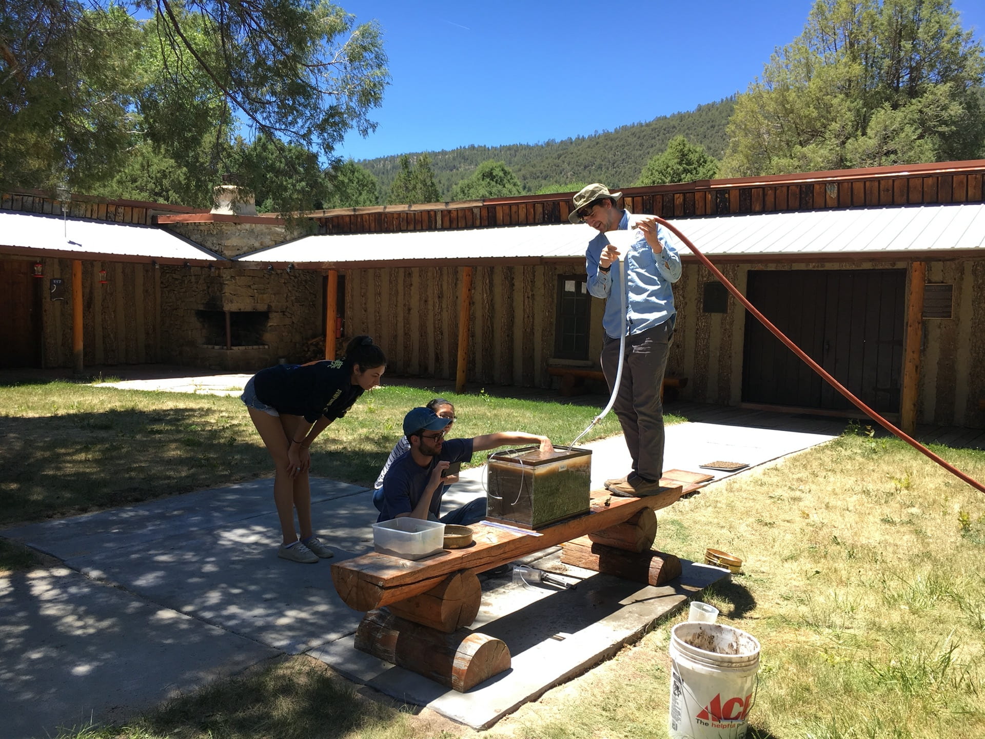
Successfully made a “beer bong” for testing Darcy’s law (image #1: Josh was advertising our invention), and we were trying to simulate a marine landslide (image #2).

*click photo to view in full size
The hummingbirds didn’t seem to care much about the “hazard” we were making …
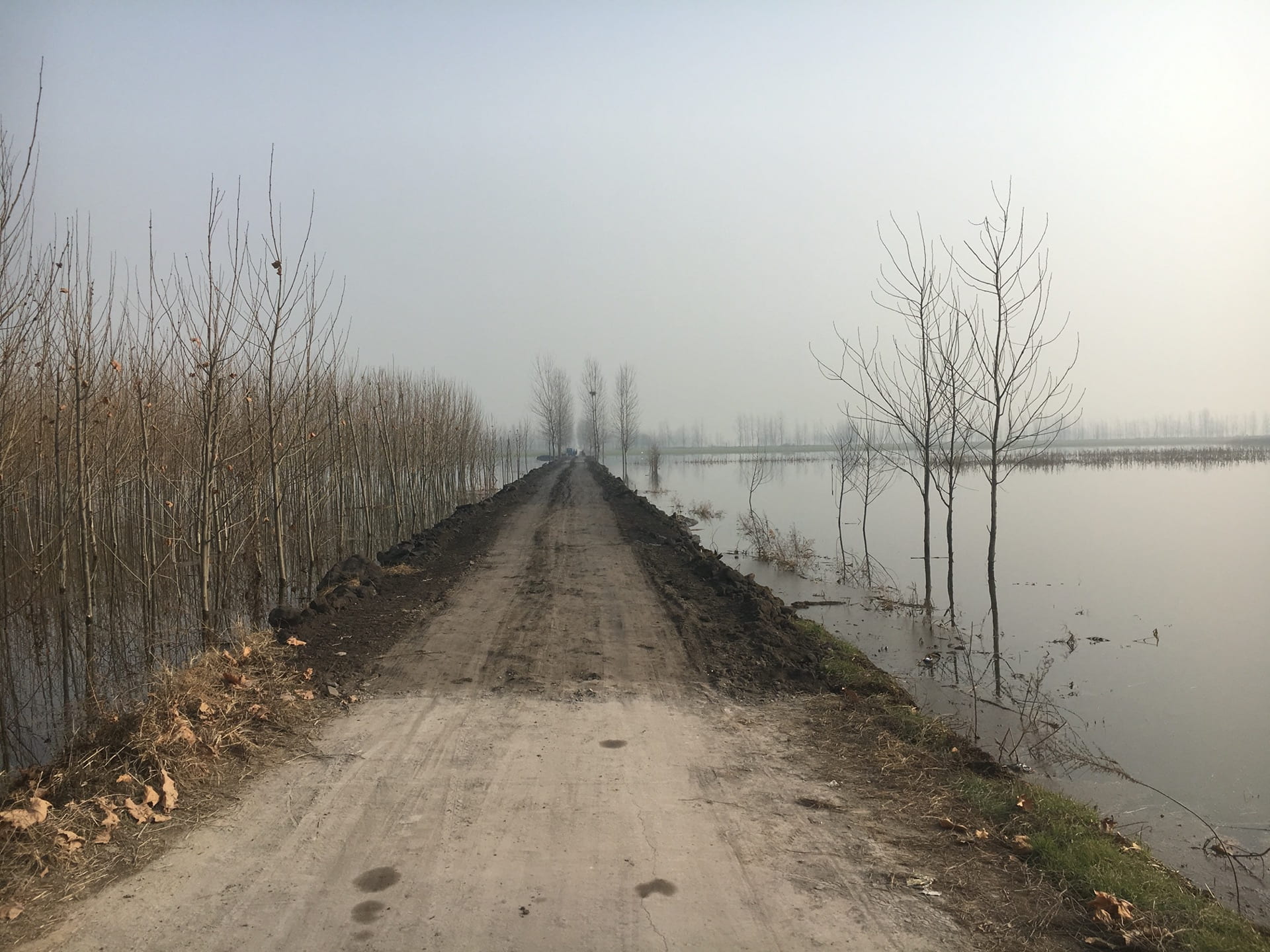
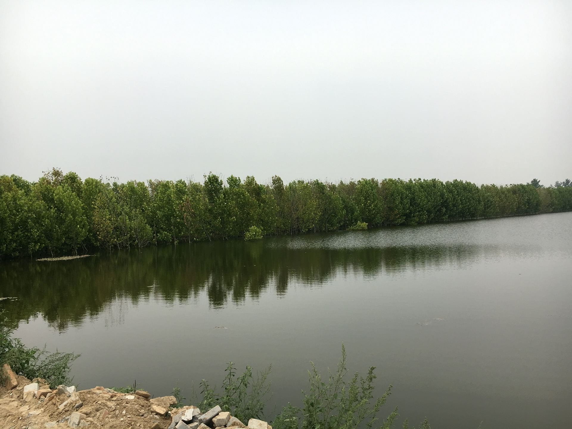
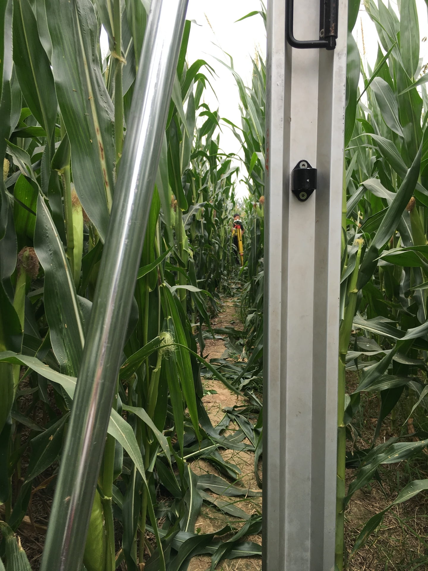
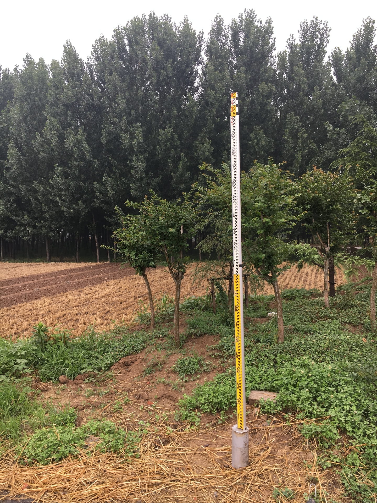
2017 Spring – Measuring ground subsidence in Jining, China
Underground coal mining caused significant ground subsidence in Jining, China. Surface water started to fill the subsided area and transformed original farm fields into a huge lake. A country road was maintained by dumping construction waste onto the submerged roadbed (image #1). Local corn farmers managed to start fishery business on their originally dry corn fields (image #2) !
*click photo to view in full size
Measuring ground subsidence in the corn field using leveling (image #1). Look! I did an amazing job balancing my leveling rod (image #2). So proud of myself!
*click photo to view in full size
We were using inclinometer to measure subsurface deformation in a borehole (image #1). Ground penetration radar was for detecting natural gas pipelines (image #2), as concerns rose that some pipelines might be damaged by the significant subsidence.

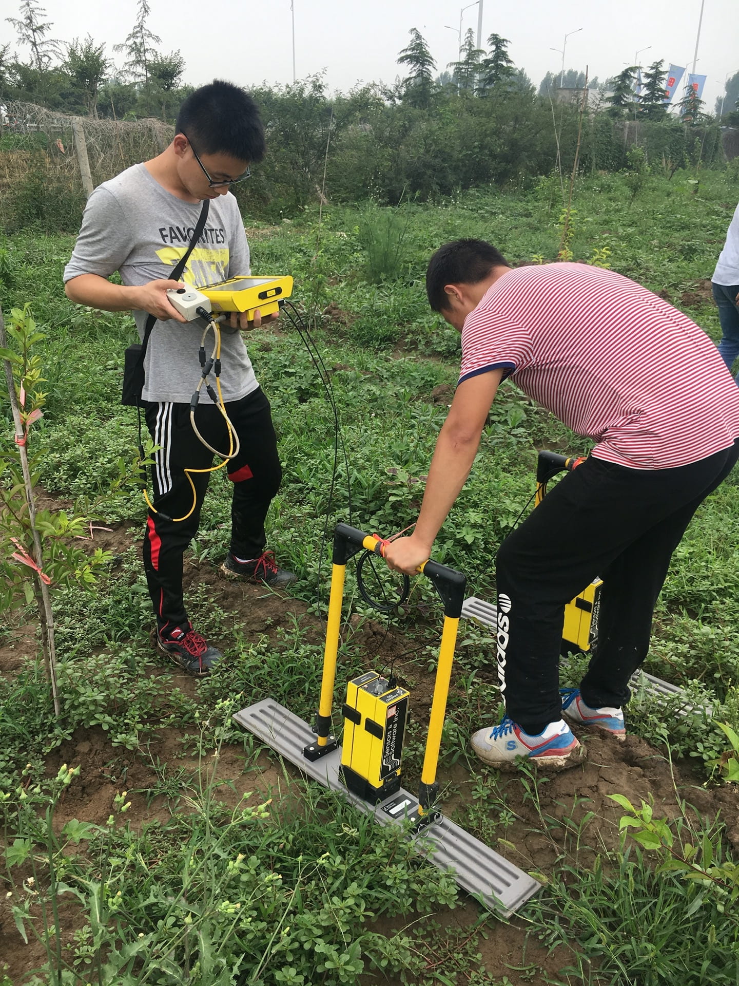
*click photo to view in full size
Simulating mining-induced strata deformation using physical models. Image #1 is more like an advertisement. Real life is like the image #2 – many failed even before we were ready to deploy sensors, especially for cases with thick and weak overlaying layers. After several fails, we were kind of mentally immune to the experiment failures, and just kept trying and trying …

*click photo to view in full size